Skip to content
Cockermouth Info
Cockermouth Heritage
War Memorial List of Names
Waterloo Street
Waterloo Street Photos & Drawings 1989
Waterloo Street Officers Report
Waterloo Street Yards 1989
Waterloo Street Maps and plans
Waterloo Street Description and Condition of Properties
Waterloo Street Description of YARDS
Waterloo Street Conversion Schemes
Railways in Cumberland
Railway Routes in Cumberland
Railway Accidents Runaway Trains
Railway Tragedy at Brigham Bridge
Railway over the Solway Firth
Railway for Dovenby Hall
Railways and Religion
Villages 1937
Bridekirk 1937
Bridekirk Runes on Baptismal Font and Sentinal Slabs
Bridekirk Archaeological Survey
Dearham – Roman – Saxon and Norman
Distington – Where St Cuthbert Stood
Eaglesfield – John Dalton and the Atom
Jennings Pubs
Explosion at Broughton Moor
Watermills of Cockermouth
Cumberland Methodism 1854 – 1954
Wheelwright Crown Street Cockermouth
About
Waterloo Street Maps and plans
Outstanding Conservation Area Map Cockermouth 1 scaled
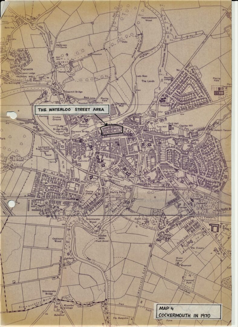
Map 04 1970 Cockermouth Waterloo Street area highlighted between Main Street and River Derwent
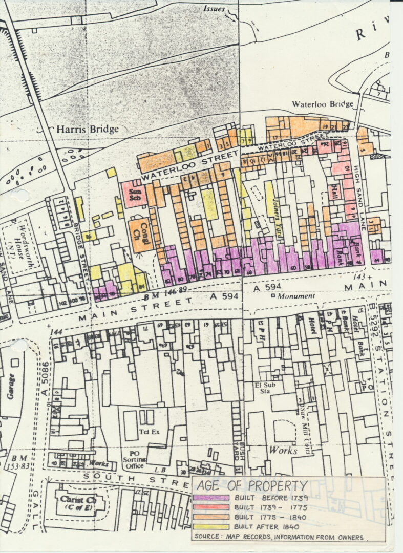
Map 01 Waterloo Street Main Street Age of property 1739 to 1840 information from owners
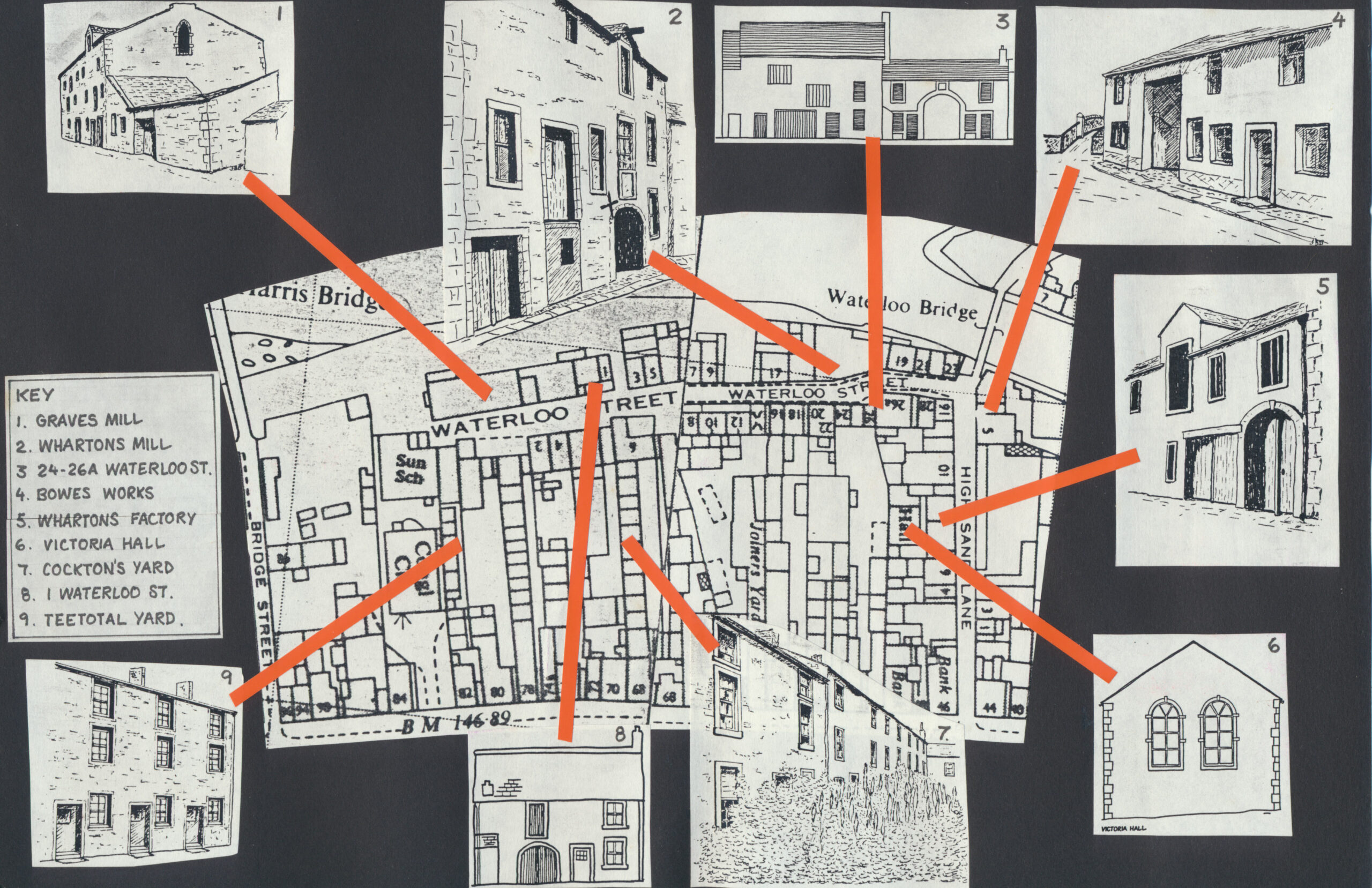
Map Waterloo Street location of significant buildings scaled
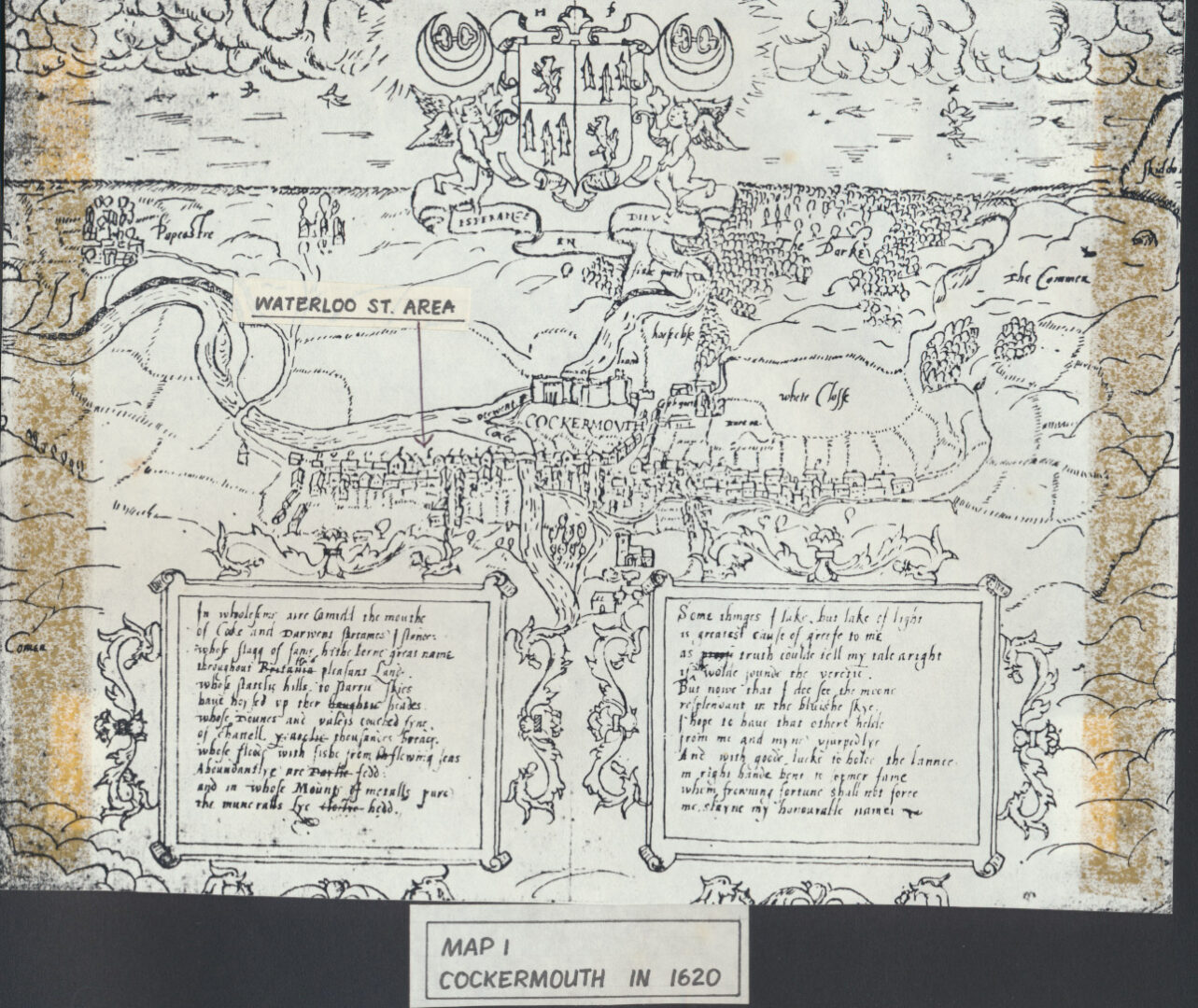
Map 01a 1620 Cockermouth
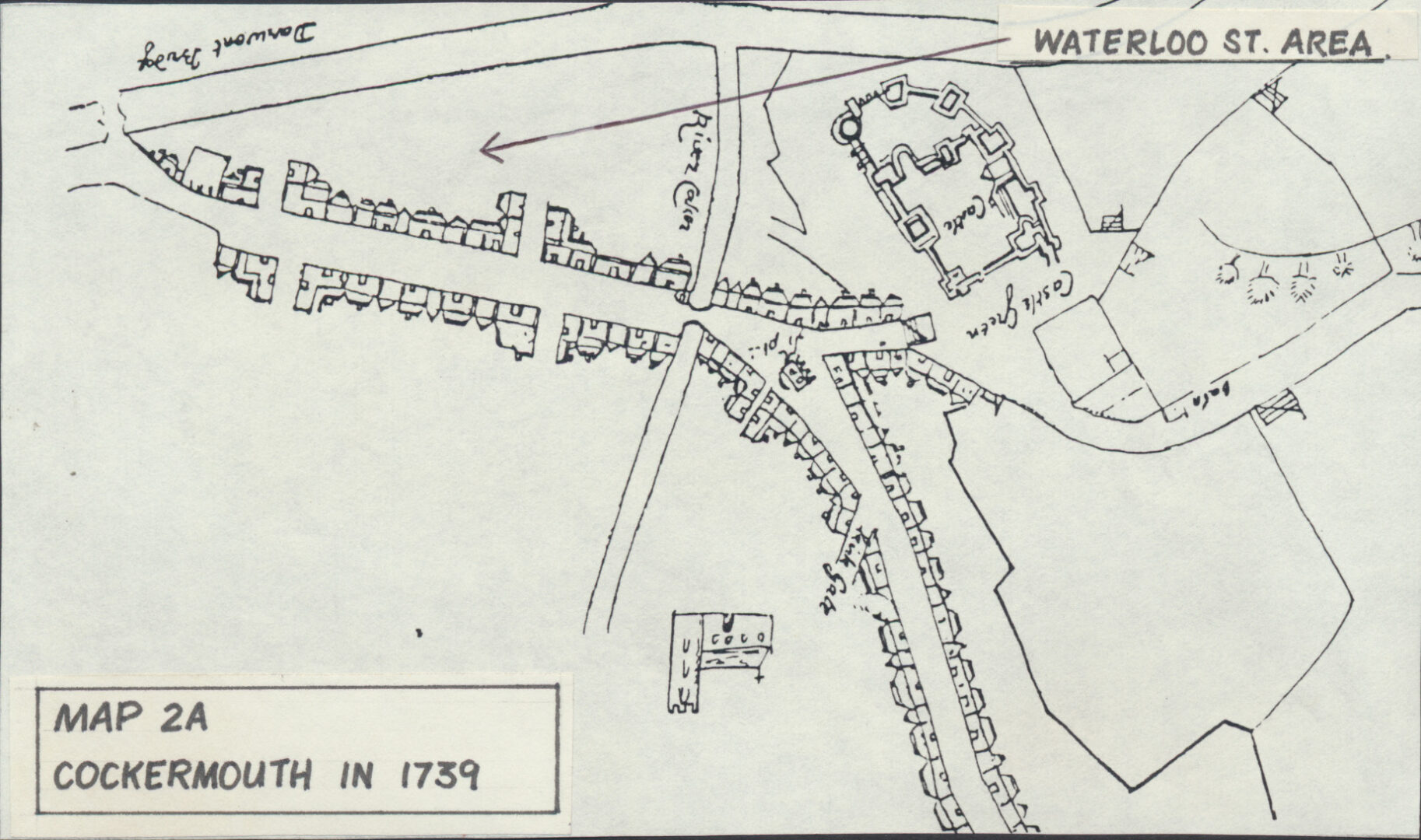
Map 02a 1739 Cockermouth Waterloo Street area
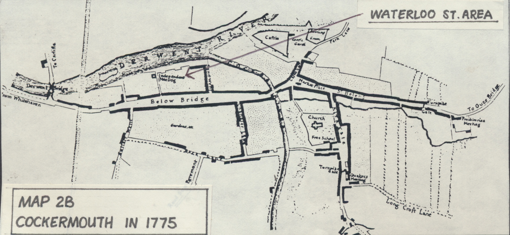
Map 02b 1775 Cockermouth Waterloo Street area
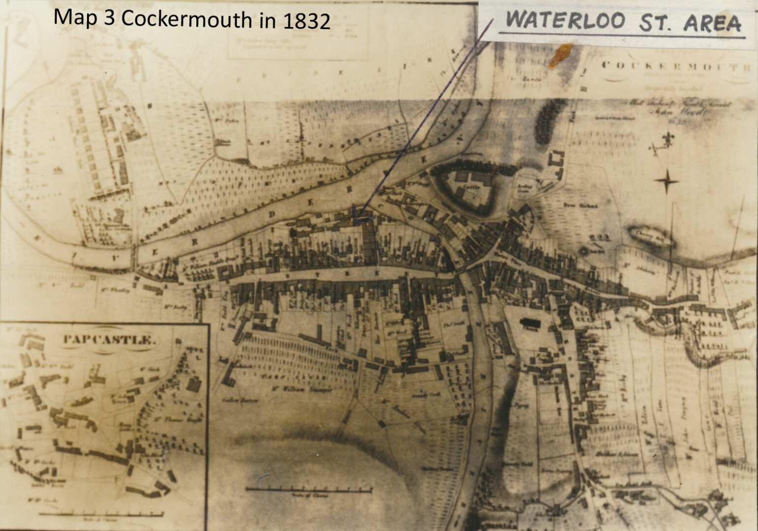
Map 03 1832 Cockermouth Waterloo Street area
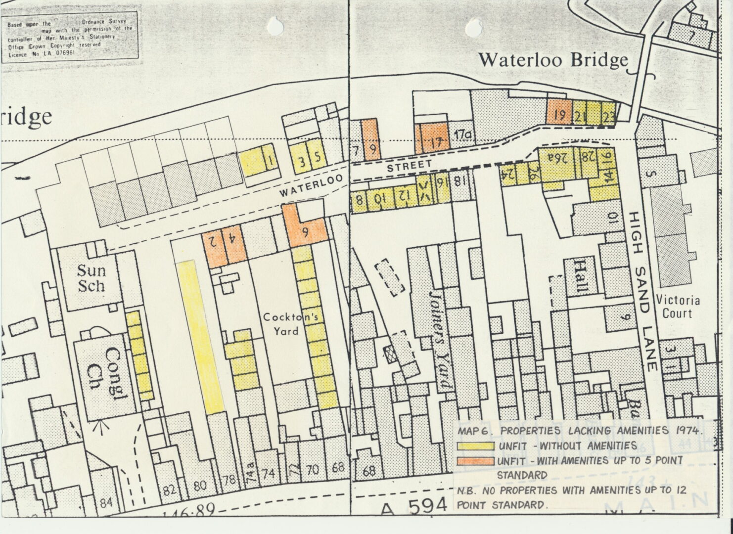
Map 06 Waterloo Street properties lacking amenities in 1974 in report of 1989 rotated
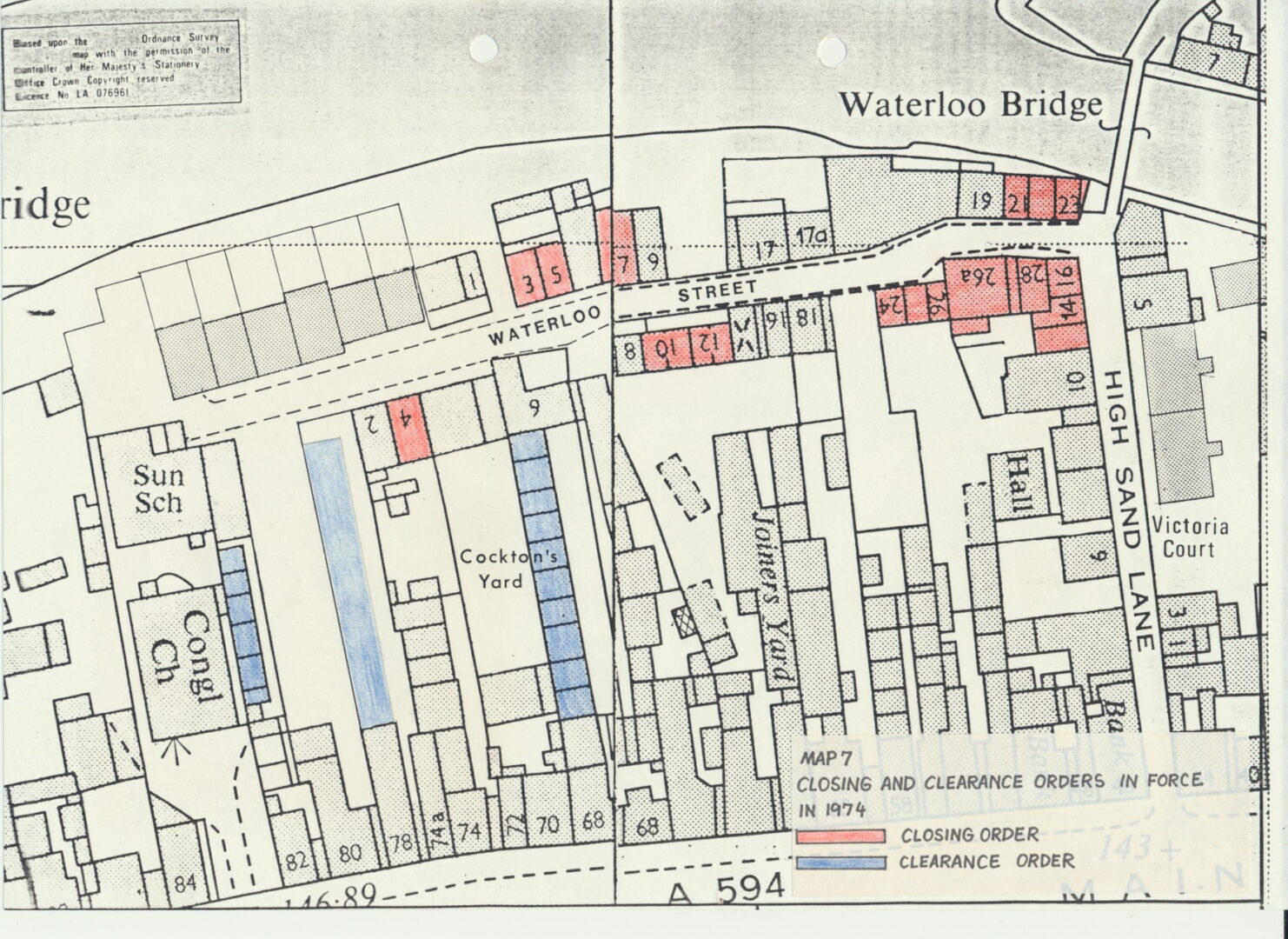
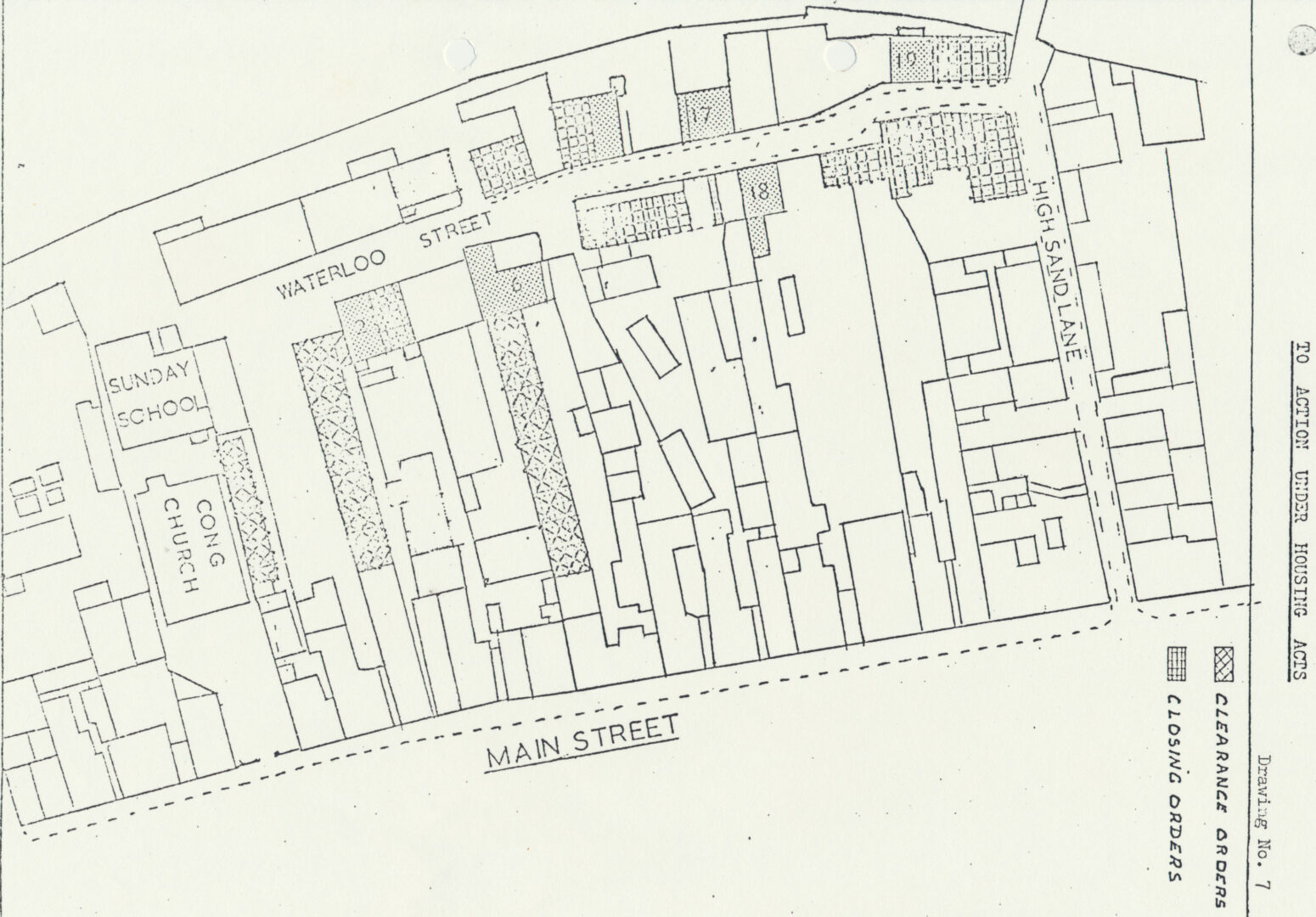
Map 07 Waterloo Street closing and clearance orders in force in 1974 in report of 1989 rotated
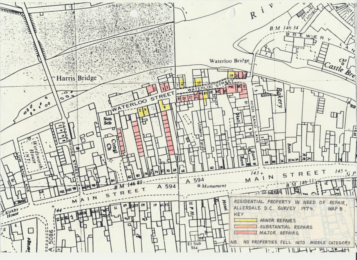
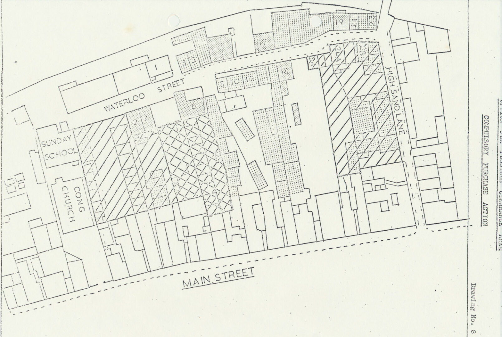
Map 08 Waterloo Street residential property in need of minor substantial and major repairs 1974 in survey of 1989 rotated
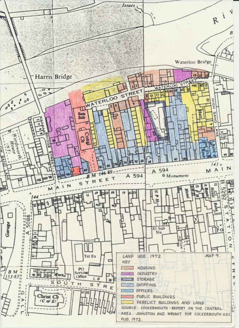
Map 09 Waterloo Street Main Street land use 1972 in report of 1989
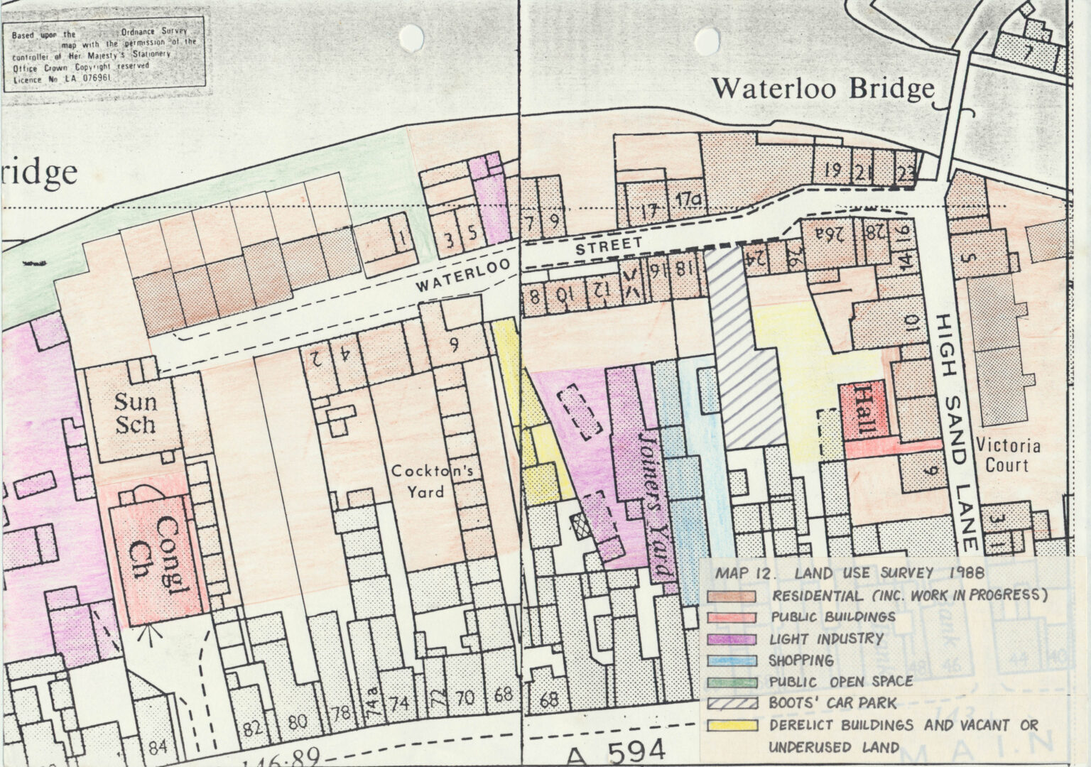
Map 12 Waterloo Street Land use survey 1988 scaled
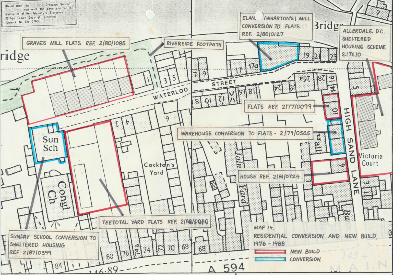
Map 14 Waterloo Street residential conversions and new build proposed 1976 1988 scaled
Map 1989 Clearance and Closing Orders on properties scaled
Map compulsory purchase of properties
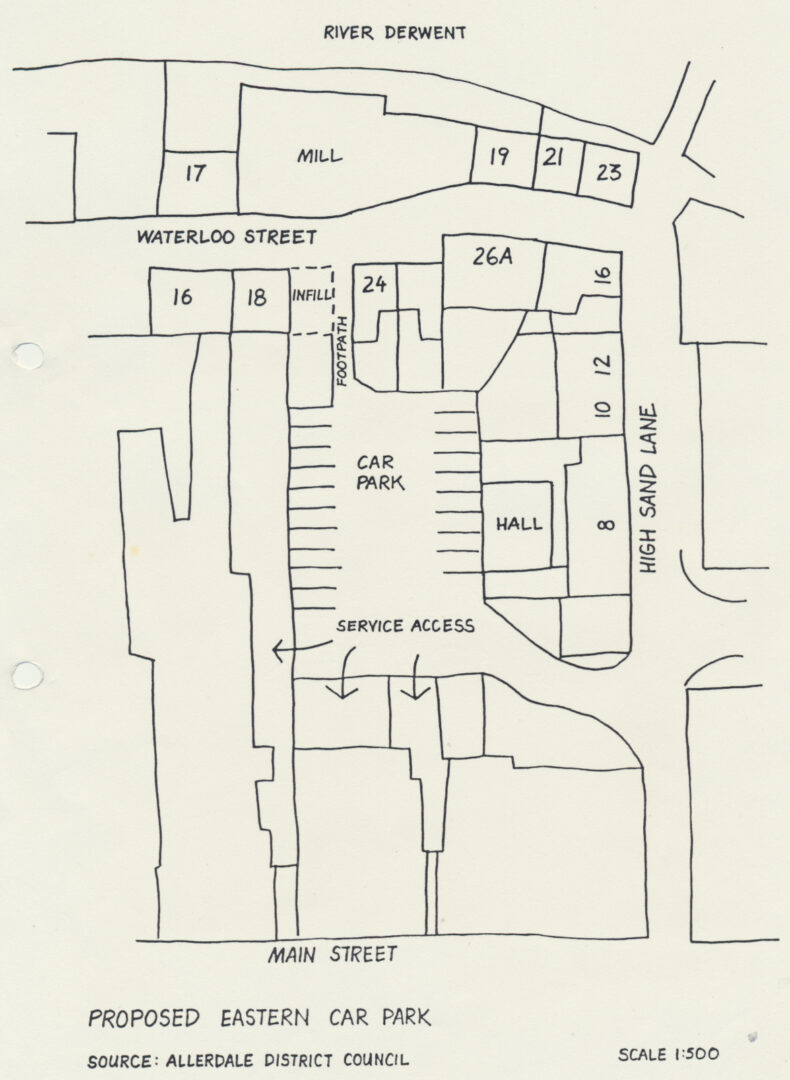
Map of proposed Waterloo Street eastern car park
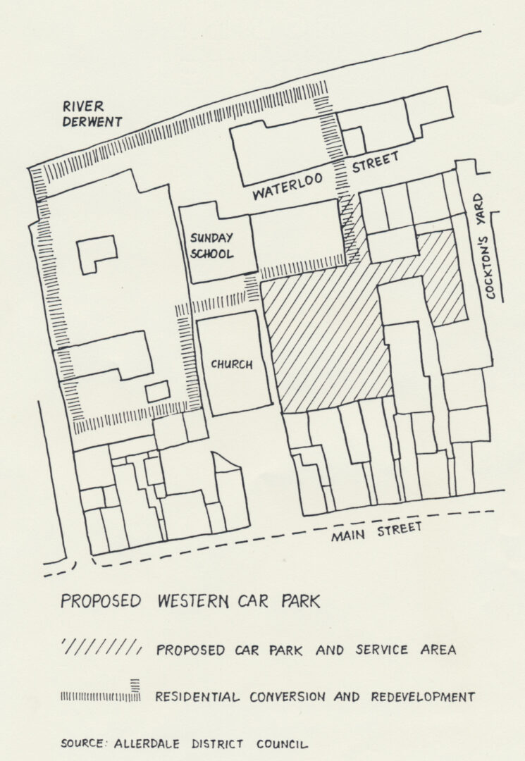
Map of proposed Waterloo Street western car park
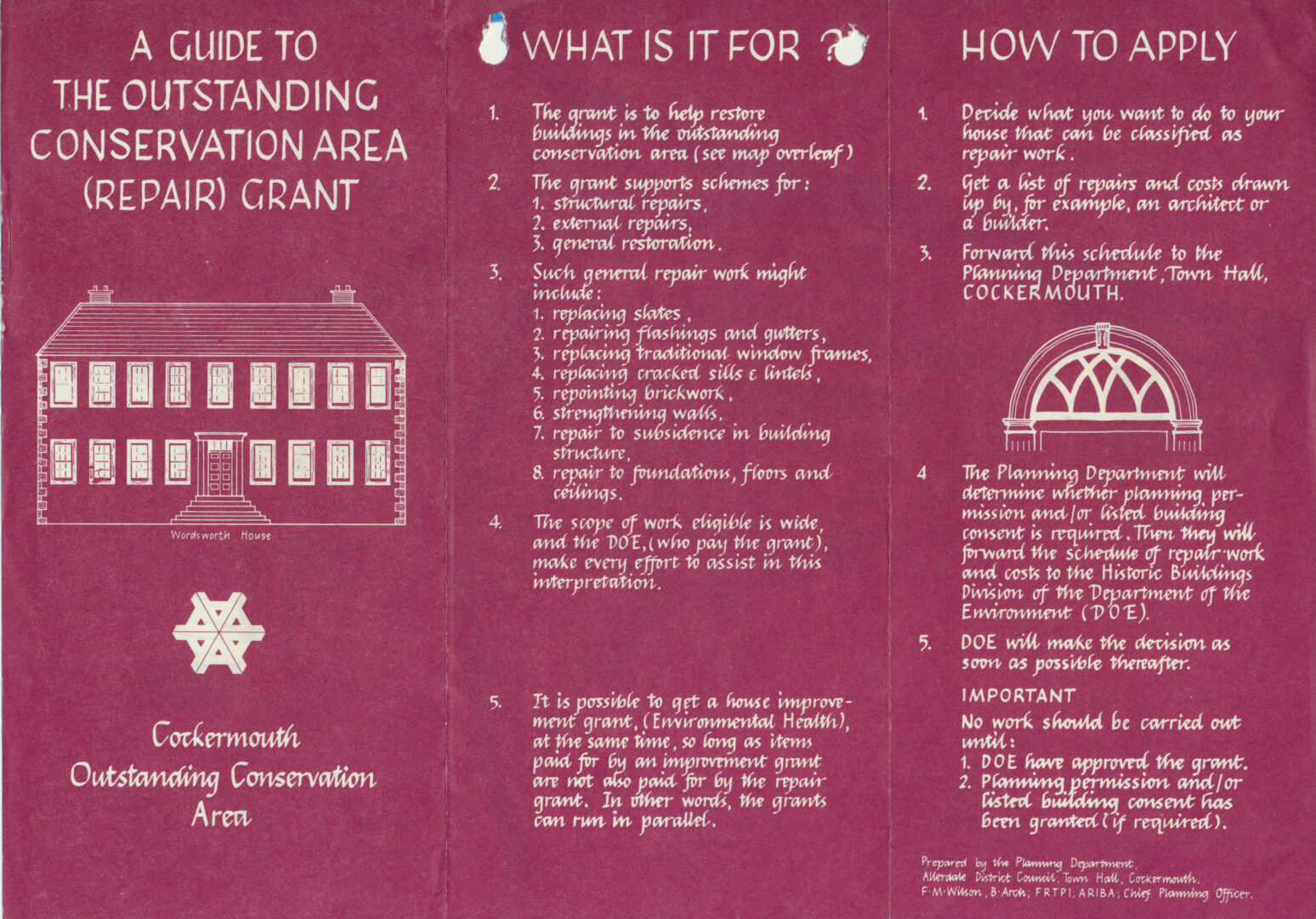
Outstanding Conservation Area guide to repair grant Map Cockermouth scaled
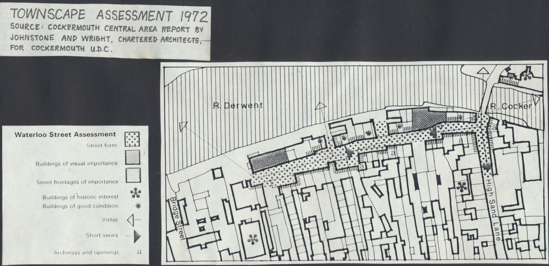
Map Townscape Assessment 1972 Johnstone and Wright Architects for Cockermouth UDC scaled
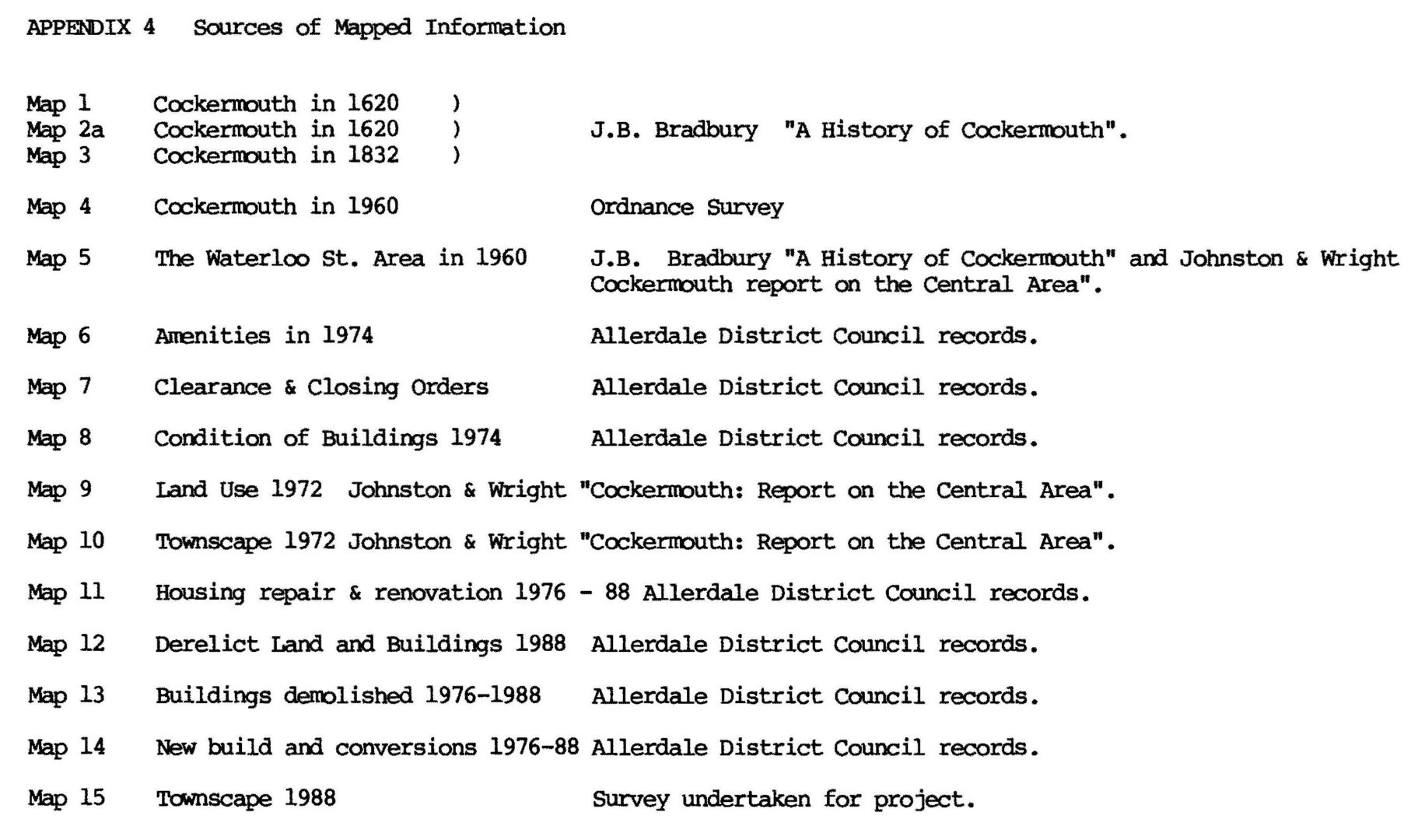
Map Sources of mapped information scaled