For a comprehensive and entertaining read about the the oddities of recruiting workers, building the viaduct and its eventual fate click this link to Ann Linegard Blog – CROSSING THE MOSS (wordpress.com)
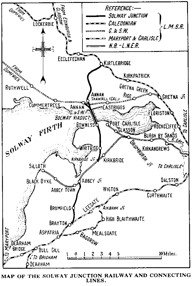
It was in the 1850s that the Solway Junction Railway was first planned as a line from the Canonbie coalfield to an intended harbour at Annan, but because of the lack of money and support the scheme never left the drawing board. The Solway Junction railway was later planned as a link between the hematite ore mines of Cumberland and the furnaces of Lanarkshire avoiding the long detour via Carlisle. But it was 1864 before the Act for the Solway Junction Railway was incorporated by Parliament, to construct the 25 mile line from the Caledonian Railway near Kirtlebridge to the Brayton Station near Aspatria on the Maryport and Carlisle Railway.
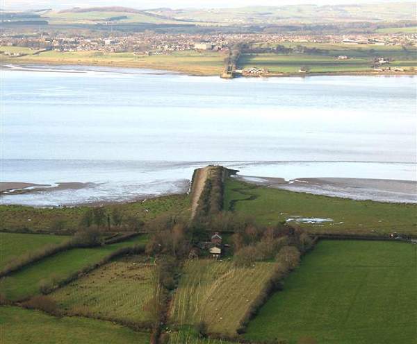
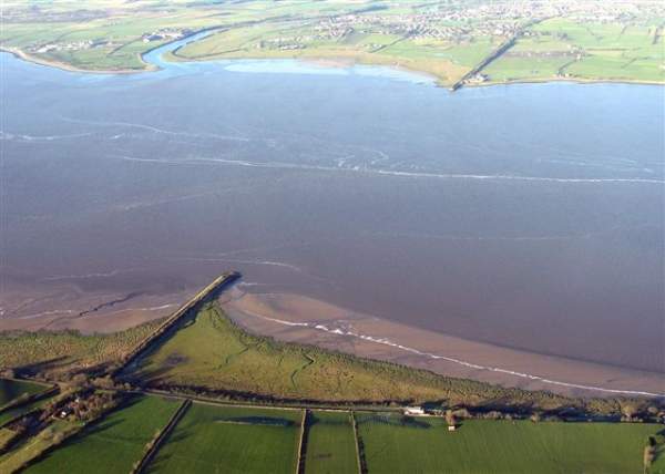
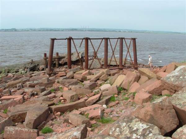
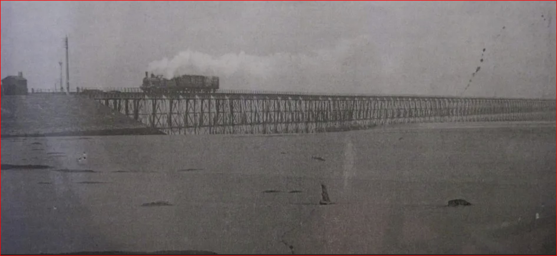
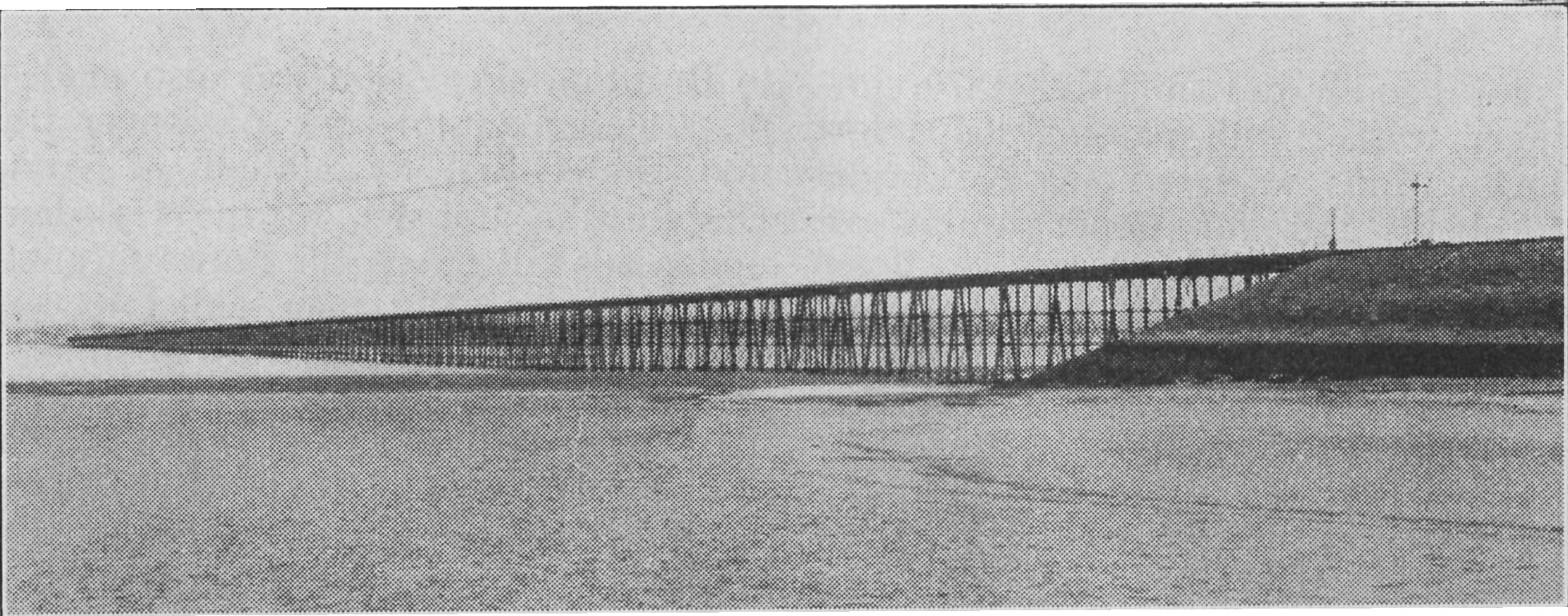
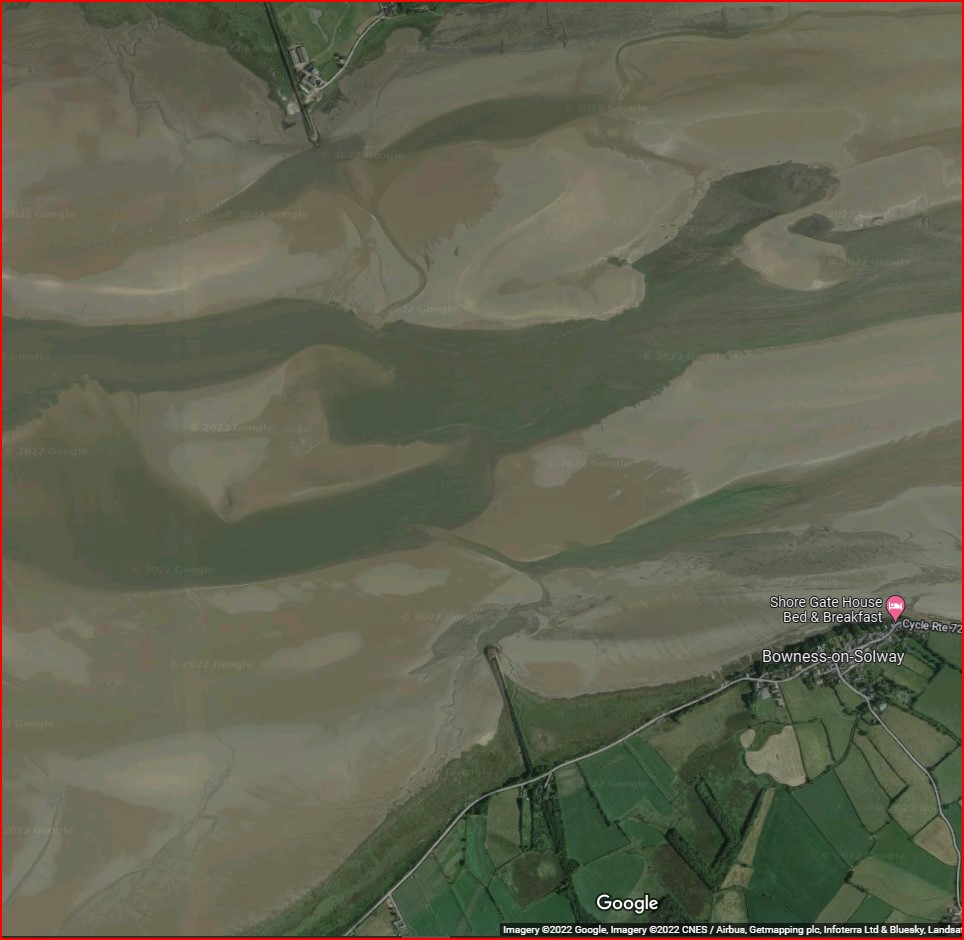
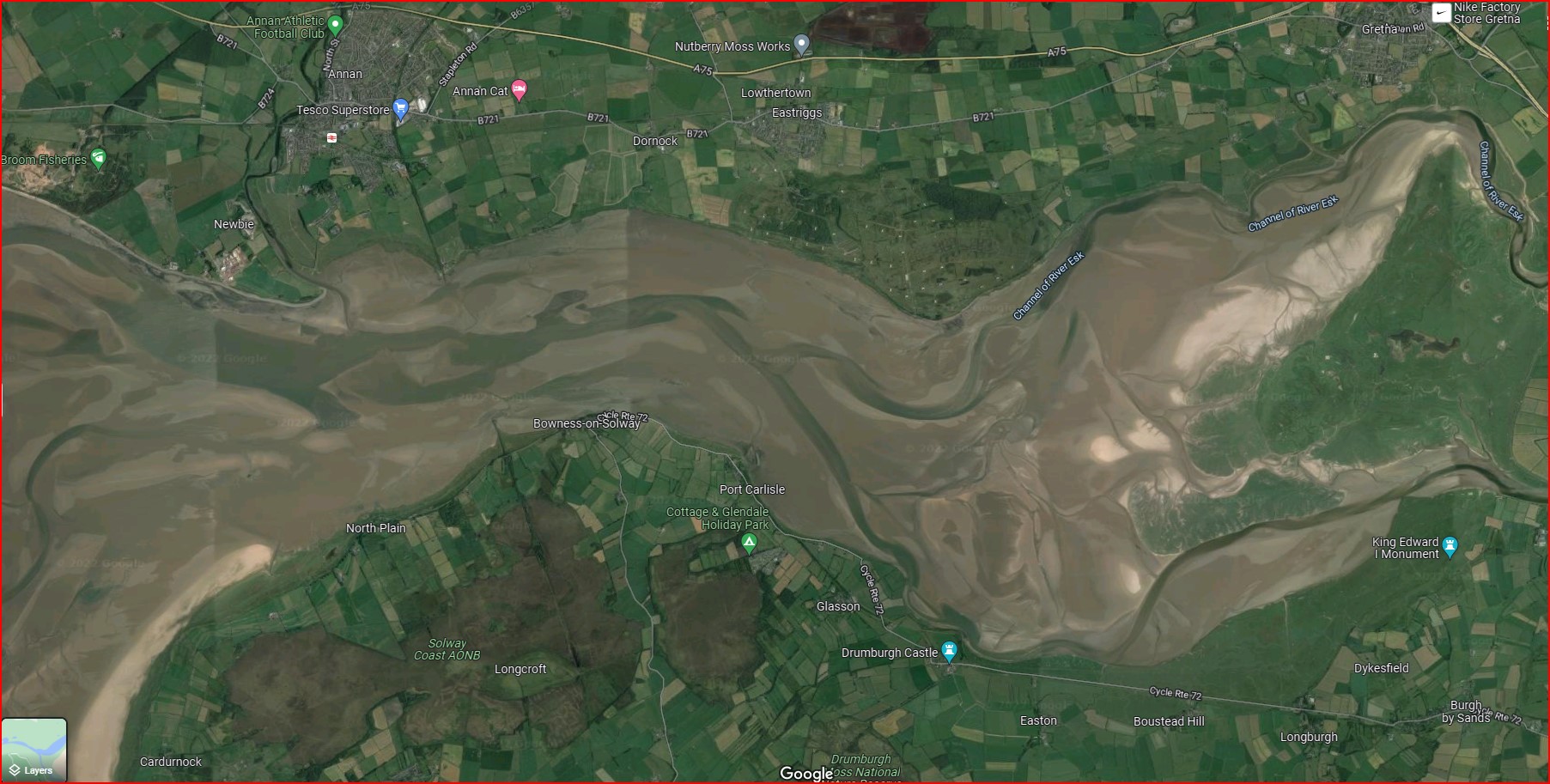
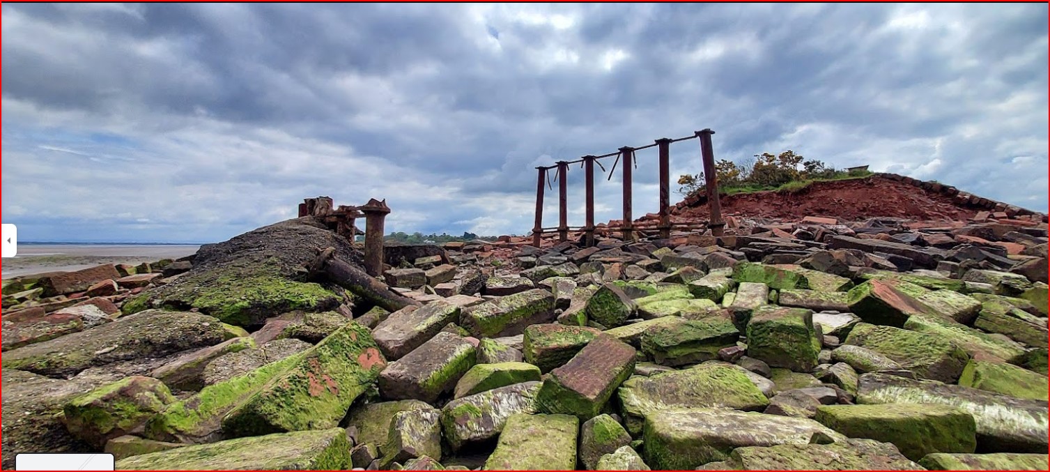
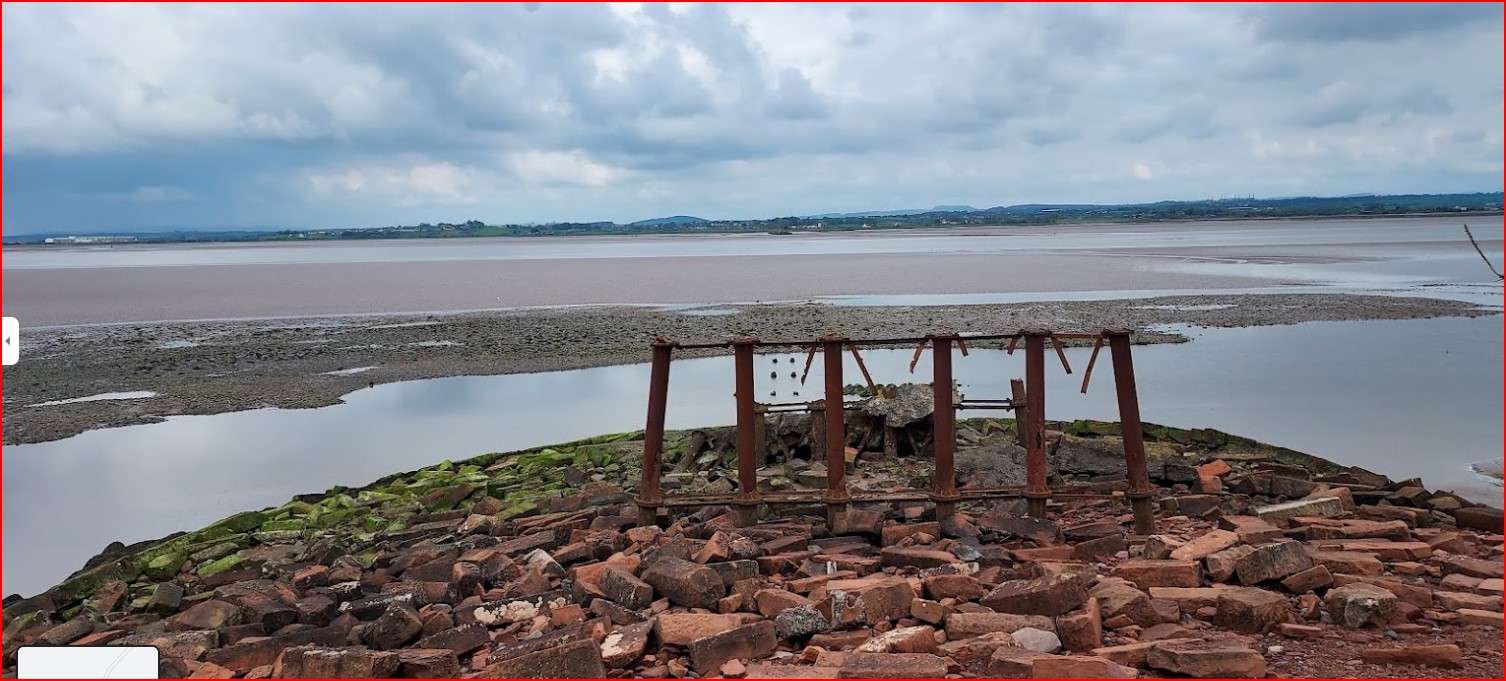
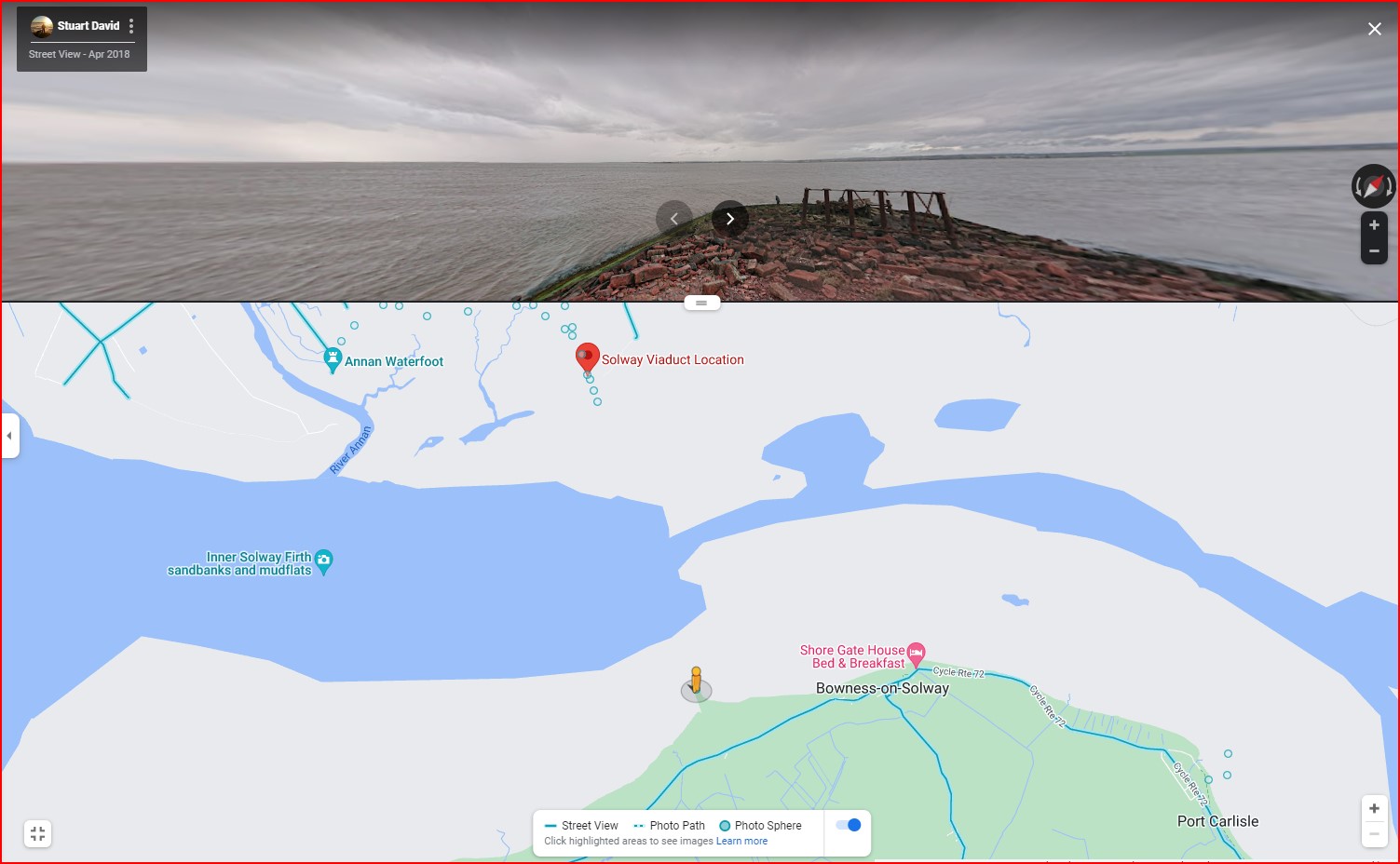
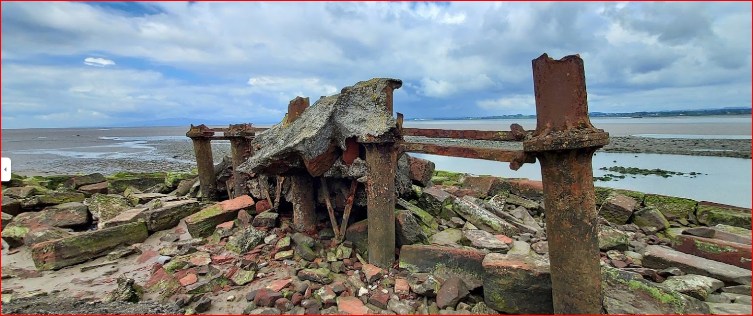
The viaduct accross the Solway and the Wampool river bridge were both designed by Sir James Brunlees. The Solway Viaduct was started in 1865 from Bowness-on-Solway in Cumbria to Annan in Dumfries with a distance of 2,544 yards shore to shore and embankments at both ends the actual length of the bridge was 1,950 yards. The distance of the viaduct was 1 mile 8 chains (1.8km) The viaduct of the Solway Junction Railway took 3 years to build at a cost of about £100,000 and had 193 spans with 2,892 tons of cast iron for the piles and 1,807 tons of wrought iron. The whole structure was erected without scaffolding with the piles being driven in at low tide. They used 5 barges in its construction which were towed back and forth by the steamer “Arabian” purchased from Clyde shipyard in Glasgow. Because of disputes over the ownership of the shore on the Scottish side it was some nine years before it could be used.
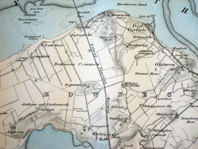
The line from Bowness side of the viaduct went over Bowness moss were ditches had to be cut as the moss was 50 foot deep in places. At Whitrigg the line passsed over the River Wampool by a bridge which had piles driven 30 foot into the seabed and then joined the Silloth Railway line at Kirkbride Junction. The Solway Junction Railway then continued on to Abbey Junction were it left the Silloth line and continued on through Bromfield to Brayton Station
For more information on Solway Junction Railway you can view a copy John B. Howes work from the early 1950’s by kind permission of Cumbria Library in Carlisle. Another excellent source is the book Th
Text from Cumbria-Railways.co.uk website Solway Junction Railway. I have purchased the book ‘The Solway Junction Railway’ published 1990 by Stuart Edgar and John M. Sinton via Amazon.
Railway over the Solway Solway Junction Railway Map.jpg
The Solway Junction Railway
This line crossing the Solway Firth must surely have been the most extraordinary and least used of all the cross-Border rail routes between England and Scotland. As with so many Cumbrian railways, mineral traffic was the reason for the project. The promoters of the Dumfriesshire and Cumberland (Solway Junction) Railway in 1862 saw the line as a shortcut for Cumberland iron ore to reach the furnaces of Lanarkshire.
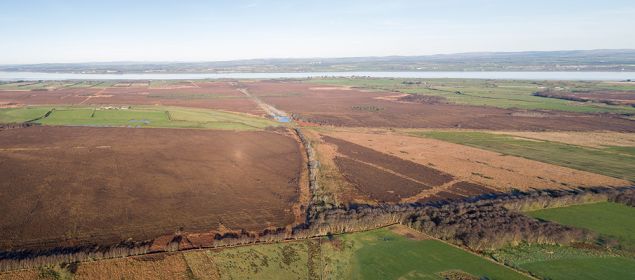
Railway bridge over the Solway aerial 1 Simon Ledingham NY 212627 Visit Cumbria com.jpg
Railway bridge over the Solway aerial 2 Solway Junction Railway NY 212627 Visit Cumbria com.jpg
Railway bridge over the Solway bridge support Solway Junction Railway NY 212627 Visit Cumbria com.jpg
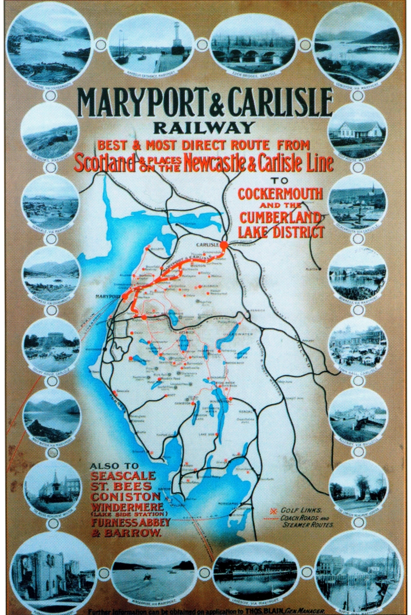
Maryport and Carlisle Railways
Routes to Scotland included the bridge over the Solway